Lots of the trips I do are more of a lasso than a circuit. Drive to some road end and walk a ways and then its off one way returning another and the trip on a map looks just like a lasso, not a circuit. This is one of the lasso trips. Just a one night'er starting Saturday and finishing Sunday.
Saturday 25/01/2014
Jessie and I met at the start of Kaitoke Waterworks road and we drove in there and parked up near some picnic tables with a sign saying "Norbett Creek Route", but its a nice marked track not a route.
 |
| Norbett Creek Route |
We headed off up that short climb and came out on the 4WD track that leads to the Eastern Hutt river.
 |
| Norbett Creek Route onto 4WD |
Followed it down and at the river Jessie headed back due to prior family stuff and I headed off to the Hutt Forks. Reckon this trip will be done again with a few extra players.
 |
| Hutt Forks |
This is a pretty nice spot where the rivers fork and there is a nice deep pool that would be a great swim spot, but its water catchment area. So that is not possible. There is a marked track heading off up Quoin Ridge but the first few hundred meters are steep and have a lot of tree fall, so it was a bit slow going to start with. Its not marked all the way to Alpha but its ridge travel so pretty easy really and as weather was clear, and destination easily viewed compass not needed. Eventually there is a fragile plant zone as advised by chunk of metal signage.
 |
| Fragile Plant Zone |
This place is not your normal Tararua's, reminiscent of Cone ridge or more like something South in NW Nelson.
 |
| Alice's Tree |
And again...
 |
| Alice's other tree |
And on again more up thru the tight forest until this clear area before going up to Quoin.
 |
| Little Plants |
Then there is the typical Tararua goblin forest to travel through before the open tops.
 |
| Goblin Forest |
And out of the bush the views of the open tops unfold.
 |
| Seeing the tops |
And something landed and we have this small infestation of alien metal before the top of Quoin. I checked but could not find a USB connection to charge my cell phone on. I think that if some tax funded agency wants to pollute our places with these metal chunks then they should provide some charge (and not coin) for the walkers as we wander by :-).
 |
| Pre Quoin Alien Zone |
And finally got the Tararua top views as required by walking and weather.
And then it was an easy wander across open tops to join the well formed Southern Crossing track and a short walk to Alpha hut, the destination. Was prepared to bivvy out in the bush expecting a full hut, but just four others there. So an easy food, beer, and sleep.
 |
| Alpha Hut |
Sunday 26/01/2014
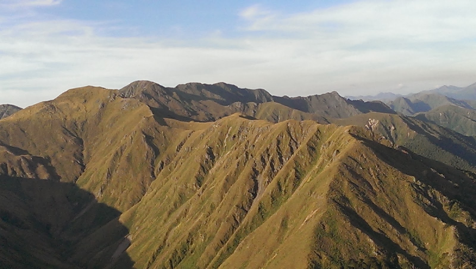
Woke eventually and waited till the others had left then rose for a nine o'clock breakfast before heading off to Alpha just after ten. The wind speed was on the increase as I headed on up. Once on top had washed views across the tops.
 |
| View of the hills |
These views are what make me stop walking and sit for a while just to look. There is a cairn at the top of the spur that leads down into the Eastern Hutt river.
 |
| Cairn on spur to Eastern Hutt river |
Now this spur is a much more interesting walk, unlike Quoin Ridge once I hit bush I lost the ground trail and had no views so it was navigation by compass. Especially in the broad areas. Overall it was nice and open, not bush bashing. Furthur down the ridge you get it narrows and the ground trail is picked up by sticking to the ridge top, and this lead all the way to the river.
 |
| Eastern Hutt river |
The hut with no name, referenced in publications as Eastern Hutt hut, but ain't no signage on the hut is a few minutes downstream once in the water. Its interesting there as there are two hut books, one from 1986 to 2010 and one from 2010 to present.
 |
| Hut with no name |
Here is the first page of the 1986 hut book.
 |
| Hut book 1986 |
From the hut it is easy travel in the water or on a trail, that's mostly on the true right, to the marked track that takes you up and over bypassing the gorge, to the swing bridge. The marked track starts a few hundred meters before that which is shown on the map. Easy travel back to the car.
An excellent trip much more fun than the over developed and over used tracks like Southern Crossing, navigation skills are more needed doing this walk. Would be fun in a storm.
Trip Times
Saturday
1157 Left car and headed up Norbett Creek route
1241 On 4WD
1319 End of 4WD
1328 Eastern Hutt river
1338 Headed off to Hutt Forks
1354 At Hutt Forks
1355 Heading up Quoin Ridge
1550 Fragile Plant area
1721 Metal gadget place
1911 On Southern Cross track
1929 Alpha Hut
Sunday
1014 Left Alpha hut
1039 On Alpha
1110 Heading down spur to Eastern Hutt river
1244 Into the Eastern Hutt river
1255 Hut with no name
1355 Left hut with no name
1527 Out of river onto marked track
1609 At swing bridge
1613 At start of track to 4WD
1633 Headed off to 4WD
1709 Norbett Creek route turnoff
1734 At car
Map Stuff
 |
| From google earth with topo overlay |
Elevation Profiles
 |
| Kaitoke to Alpha hut via Quoin Ridge |
 |
| Alpha hut to Kaitoke via Eastern Hutt River |
Density
None. Alpha hut and hut with no name clean.