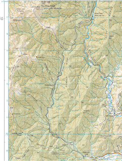
Bannister from Arete

Paul and I on another go at Bannister, we always have hit real bad weather in all our previous attempts. This weekends forecast looks promising. Whisky was a single cask Caol Ila.

Friday 28/01/2011
Drove to Poads road and walked up South Ohau river to South Ohau hut, stopping for a snack and then on up to Te Matawai hut. I got there Friday night and Paul turned up very early Saturday morning, like three minutes into it. The following two photos are of Wainuia urnula out on the track on the way up from South Ohau hut at 2305.
Wainuia urnula
Wainuia urnula
Saturday 29/01/2011
We slept in till nine and hung around at Te Matawai until about eleven when the rain stopped. Off up to Arete with a few squalls on the way. Like this waterfall when its got water, bowls look worth checking out.
Waterfall on ridge opposite
From Arete SE to Arete Hut
Once at Arete Hut we decided to stay for Saturday night and head off up Bannister as the rain had stopped and it was just windy with low clouds coming and going and we could see it.
Bannister
At times cloud surrounding us and our destination. The closer we got the less steep Bannister looked.
Looking at Bannister
We got up and over Bannister and then back over and down to Arete Hut. We had read that some parties took a rope for Bannister, however there where no places where a rope was needed, we never went as far down as the "mud step". Much less exposure than the Tararua Peaks.

Sunday 30/01/2011
Left Arete Hut in windy clag, worse than yesterday.
Arete Hut
Headed down towards Te Matawai and went down to Girdlestone Saddle and dropped off down to South Ohau hut via the Dowling falls track.

Trip Times

28/01/2011
1917 Left Poads Road
2006 Into the Ohau river
2035 North South Ohau junction
2137 South Ohau Hut
2141 Paul arrived...
2213 Left South Ohau Hut
2317 Junction
2331 Otaki river track
2343 Te Matawai Hut
29/01/2011
0003 Paul arrives Te Matawai
1132 Left Te Matawai
1255 Pukematawai
1332 Arete
1348 Arete Hut
1436 Left Arete Hut to head to Bannister

30/01/2011

Map
Cleaning Up
Two density tracts removed.

Cattle Ridge 14-16/01/2011

A trip aiming to cross Bannister from Waingawa to Arete ended up into a wander over Cattle Ridge down to Roaring Stag and some wandering in the Ruamahunga river. Paul and I headed off Friday afternoon with what seemed the perfect weather. We walked up Waingawa Saturday morning and when the full force of the wind hit us we changed our Bannister walk into a Cattle Ridge walk.

Sunday's gorge travel added another four hours onto our day as we didnt notice we where heading East for a couple of hours, walked right past Cleft creek. Such enjoyable rock hopping river wading.

Friday 14/01/2011

1920 Left the car at Kiriwhakapapa Road end and started walking to either Cow Creek hut or bivvy site up Waingawa..
2023 Blue Range turnoff.
2121 Waingawa River turn off, and Cow Creek it is, felt it was too dark to go down track not maintained to Cow Saddle.
2221 Bridge to Cow Creek.
2224 Cow Creek hut.

Saturday 15/01/2011
Another picture of Cow Creek hut.
0736 Headed across the Waingawa river looking to head up the old ridge track, gave up on it and headed East to join up with the Cow Saddle track.
0826 Cow Saddle.
0917 Into the open, waiting for the other one. Flowers are looking good.
1058 On the top below Waingawa and the wind is getting up.

1243 Cattle Ridge hut and stopped for snacks, finally out of the wind.
1319 Off down to Roaring Stag Lodge.
1405 At Roaring Stag, waiting for him again.
1525 Down the Ruamahunga looking for a sheltered bivvy spot, as there are gusts of wind that put waves on the river.
1639 Got ourselves a good bivvy site for the night. Time for a swim in the deep pool and after our evening meal we settled back and consumed the Elijah Craig 12yo bourbon. Both deciding that a good single malt from Scotland is superior.

Sunday 16/01/2011
The big day for us due to not noticing that we wandered past Cleft creek. two hours of cruising down the river in the sun enjoying the walk and then realisation that we where going East and not South...

Seemed to be rain coming so we packed up quickly and headed off.

0844 Off down the river.
0927 Wandered past Cleft creek had lost the plot with South and East becoming meaningless noise.
1139 Realised we where wandering down the Ruamahunga river and that all we needed to do was get up on the bank and head North along the track.
1147 Now on the track, missing the river.
1303 Roaring stag hut sign.
As we wandered into a creek bed saw a pinkish looking weta hop away under a log. Went and took a few photos as its not a sort Ive seen before in the Tararuas.
1427 At the slip and on the way up to the saddle.
1444 Cow Saddle.
1557 Waingawa River sign.
1704 Blue Range hut turnoff.
1754 Back at the car, waiting for him.

Map of our Wanderings

Cleaning Up
No density to remove.

Mid King Bivvy

Adrian and Ian doing a trip to a wee bivouac never visited by either of us.

Friday 07/01/2011
Adrian drove us away from work at approx 1600 hours heading for Mt Holdsworth car park. We got there and headed off to Atiwhakatu hut to stay the night there. Not raining not cold.
Adrian on bridge
Got to Atiwhakatu at eight thirtyish. Sat outside for a pre sleep whisky or two. The dogs in the hut reeked so I took a mattress outside to sleep under the veranda. Warm night with a few showers.
Atiwhakatu Hut

Saturday 08/01/2011
Just after eight and we where up and away from Atiwhakatu hut heading up the river track to Baldy and then up onto South King.
Adrian ready to go
Adrian out on Baldy
Typical views
Adrian
Broken Axe Pinnacles
From a bit past South King we headed down a ridge in a direct line to Mid King Bivouac.  Had a discussion on what way to get to the bivouac, direct route won out after a bit of wandering around.
Adrian in the distance
Mid King Bivouac in the distance just before an hours bush bashing thru leather wood and a stream with a few waterfalls, a bit of a work out.
Finally at the bivouac and it was empty, with a log book back to 1999. The bivouac is called Mid King Bivvy, the map calls it Mid King Bivouac. Good stuff.
Approaching Mid King Bivouac
Mid King Bivvy
The Mid King Bivvy bivouac
Mid King Bivvy and fire exit
 Good to be here finally after a few abandoned trips due to normal Tararua weather. Ate food up on the ridge where we had views of the Kings and Peggys peak.
Dinning table
View from the dinning table
Sunday 09/01/2011
Woke to a morning of clouds, being in the clouds.
Adrian and the bivouac
Wonderful weather for a walk thru the stunted forest. Down the ridge that is mostly tracked and into the river. That is an enjoyable walk with the clouds hanging close.

Trip Time
07/01/2011
1844 Left Holdsworth car park
2024 Atiwhakatu Hut
08/01/2011
0816 Left Atiwhakatu Hut
1054 Out of the bush heading up Baldy
1521 At Mid King Bivvy
09/01/2011
0856 Left Mid King Bivvy
1112 Into South Mitre stream
1415 At Barton Baldy track junctions
1424 On again
1522 Atiwhakatu Hut
1701 Holdsworth car park

Map of the Route
no density to remove.

Poor Pete's Hut

This is the first tramp of the year and a one night only for checking out the Matiri and popping up onto 1000 acre plateau. First time into this area.

Saturday 01/01/2011
A nice drive to Murchison and a visit to the info center where I was advised that the Matiri Valley track is closed as it is very dangerous due to a massive slip. Decided to give it a go as it sounded like it could be a challenge, the info center staff thought that was a bad idea.
Matiri Valley Road
Matiri West Bank Road
Sagar Road
End of 4 wheel track
A nice 16km drive from the road end to the parking area, if in 4 wheel drive there is more road to travel, not much though. DOC stuff says three hours to Lake Matiri hut, but its only an hour and a half for fit people. And there was no dangerous slip or anything that could close a track.
Lake Matiri Hut
Left the hut at quarter past five and headed off up to Poor Pete's hut, what a great walk, love the bit where it flattens out and there are some views down to the lake and of the hills on the other side.
View of Lake Matiri
From the nice viewing lounge it was more up through bush until out in the open and finally on the 1000 acre plateau. A very muddy looking Lake, may be from the last few days of rain.
One thousand acre plateau
Down and across to Poor Pete's hut, probably a brisk ten minute walk.
Poor Petes Hut
The hut is leaky and run down, looks like it could fall down soon.
Poor Petes Hut
View of Plateau
Thought about staying here the night or heading back down to Lake Matiri hut. A fellow tramper arrived and he had had a much longer day than me so I decided to head back to Matiri hut. Only took an hour and quarter to get there; compared to two hours up. The Lake Matiri hut was not full so stayed there the night.

Sunday 02/01/2011
A quick walk out, less than an hour and a half.  The mud color water is in need of investigation, must come again and see if the lake is same color. The slab across the river would be a fun climb.
Matiri River
A dream slab
The picture below is the "dangerous" place. What a load of rubbish, and the exaggeration probably lives on.
The slip
Relaxing drive back to Nelson and then a cold Weka lager. All in all a great one night'er and an area to go back to for a few days.
Weka beer
Trip Times

01/01/2011
1522 Left car at Matiri car park
1617 Gate at end of 4 wheel track
1647 Lake Matiri Hut
1718 Left Matiri Hut for Poor Petes
1722 Sign to Poor Petes Hut
1809 Up high and good views
1922 On the plateau
1942 Poor Petes Hut
2001 Left Poor Petes Hut
2129 Lake Matiri Hut
02/01/2011
1031 Left Lake Matiri Hut
1053 At the gate
1146 Back at the car park
 
A map of the area wandered

and there was no density to remove from huts...