Fishtail

Friday 27/12/2013
This a cruise to sort some access to some ridges this way and that way and never sure of which way as the wx was not in tune with the requirements of my journey. Heading that way that gets me there and the stones and trees give me the desire to complete some journey.
Got there to that Fishtail hut that evening with some visibility to the horizon available.
To the hut to the shelter and then there is the Smokehead to know that the shelter is gained.
Saturday 28/12/2013
It stormed it rained it clouded and eventually the next evening it cleared just for a short time. This is what we seen when it cleared looking the way that we came. So off the other way.
Heading up to the ridge line to a view of the other side and an ability to make a phone call.
The boiling cloud view pre whisky time.
And then back to the hut with blue sky vapor feeding frenzy prior to the rain.

Sunday 29/12/2013
A home wandering day after hours of reading and watching for the weather to change. Stones collected white colored there they lay.
And on down...
Tripping Times
27/12/2013 Friday
1536 Left the car park
1600 At Pine Valley Hut
1619 In the river before the up and up
1849 At Fish Tail Hut
28/12/2013 Saturday
Done nothing this day except for some top wandering when the rain lifted...
29/12/2013 Sunday
1639 Left the hut at move fast speed for car in the valley
1808 At the river crossing. Nothing.
1829 The hut
1859 At my car in the car park. Vroom.

Map of Fishtail


Kime Elder Renata Loop


Friday 6/12/2013
Got a half day off and used the afternoon to drive to Otaki to visit Mum and Dad and then to Otaki Forks car park. Left the car park just before five and by the time I got to Tirotiro Knob cloud was hugging the trees. Stopped at Field for a meal and a density check.
Field Hut
Left Field still in single layer as quite warm, passed a few fellow trampers just before getting onto Table Top. On Table Top with wind increasing and some semi horizontal rain, had to add the coat layer. Got to empty Kime hut before nine, never needed to use a torch. The wind and rain increased over the next few hours. Safe in the shelter of Kime relaxed with a dram and ebook. With the cell coverage here got an updated weather report and it looked good for Saturday afternoon. So loved the weekends whisky that the entire bottle is now empty. The best bottles of whisky always look like this.
Springbank 15 years old
There is something magical about fifteen years of age, Springbank rocks, Glendronach rocks, Highland Park does too, Laphroig did when they did a fifteen. My view is that a whisky starts to come into being as a very spiritual dram at this age or later; anything earlier and its just an excessive taste.

Saturday 7/12/2013
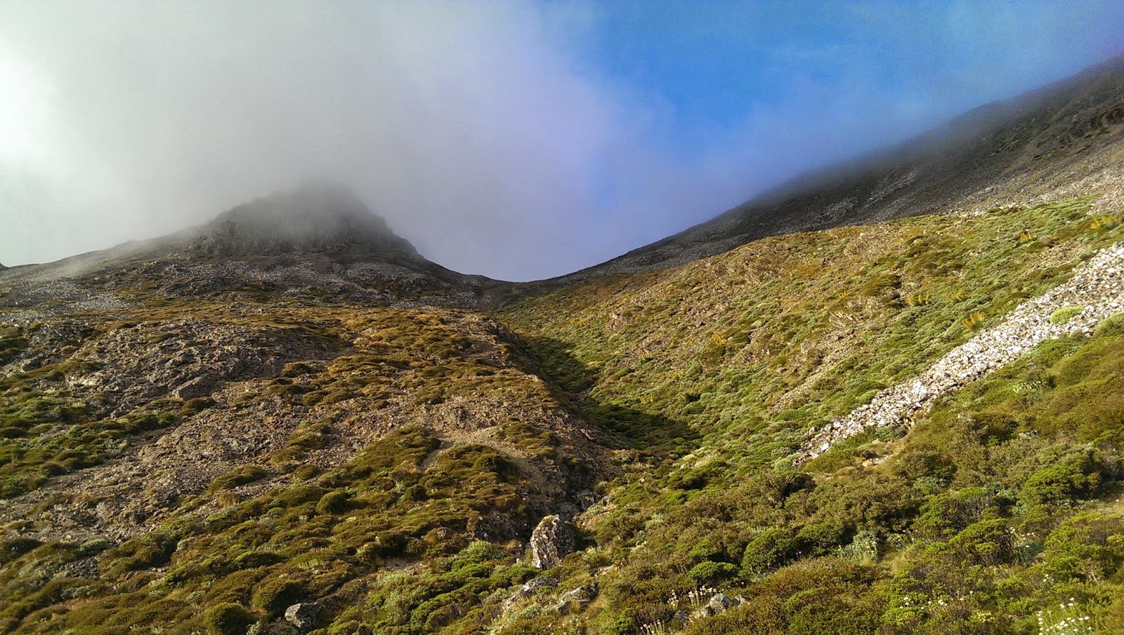
Expecting this to be a big day and difficult in the projected storm, or even a pass. Want to head up and over Field Peak, Mt Hector, The Beehives, Atkinson, Dress Circle, Aston, and then head West to Elder hut.

Up early to heavy wind and rain coming and going, decided to sleep until eleven and then make a decision whether to go over the tops and down to Elder. Off after twelve to get to at least Hector and if getting thrown around I would abandon.
Hector
So far to Hector it had not been too bad, worst wind was on the top. So decided to continue and then it just steadily got worse, skin battering horizontal rain and wind that had me crawling over the exposed steep bits. Especially between the Beehives and Aitkinson. Really looked forward to getting into the bush on way to Elder. The wind on cone looked like this, ment steadily more gusty but I beat the worst and was at Elder before it got real fast.
Cone Ridge Wind Info

Elder Hut
After a relax from the wind and rain at Elder (and a density removal) on down to Renata hut to sleep Saturday night, never stayed a night there yet. As I have visited all the huts in the Tararua's bar one (Eastern Hutt emergency hut), and I have slept in them all except Renata, North Mangahoa Biv, and of course the Eastern Hutt one.
Renata Hut
Renata Hut
Renata Hut
Six others already there, still a comfy night as there was more mattress than bunk space and I slept on the floor. Before sleep had a dram of the delicious Springbank 15 year old.


Sunday 8/12/2013
Headed back to Otaki Forks via Waiotauru track. Very fast and easy travel as its a four wheel drive track all the way to the hut. Looks like its been a dumping ground for stolen vehicles.

What a dive this hut is, rubbish every where, and no fire box any more! Brushed the rat shit off the table and sat down for a cup of tea and crackers.
Waiotauru Hut
I wonder about my shoes, they seem to have done well, even though the side stitching failed a few months ago. It seems a little bit scarey that in the last few years a pair of shoes for tramping only lasts six months to a year and or approx 500 to 800 kilometers before being really worn out.

In 2010 I had a pair that had lasted me almost eight years. The first six years probably only did a few hundred kilometers per year. 2009 and 2010 I did forty weekend trips with them before they where no longer useful.

The old machinary.
Something steam
Some more steam
Even more something steam
Trip Times
Friday 06/12/2013
1642 Left Otaki Forks carpark
1804 Point 1km from Fields hut
1837 At an empty Fields hut
1908 Left Fields hut
2038 At Kime hut
Saturday 07/12/2013
1251 Left Kime hut
1326 On Hector
1457 Entered the bush on way to Elder
1545 At Elder
1626 Left Elder
1853 At Renata
Sunday 08/12/2013
0902 Left Renata
1001 Car wreck corner
1052 Waitauru hut
1155 Left Waitauru hut
1212 Into the river
1255 Swing  bridge
1417 The field of anchient steam based machinery
1440 Picnic area
1504 Back at the car

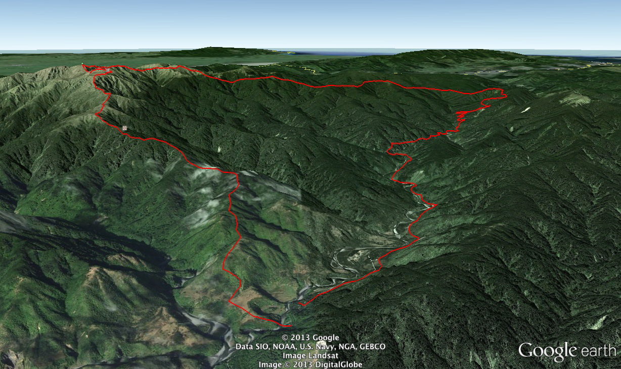
Google Earth View of Walk
Otaki Forks - Kime Elder Loop
Density Removal Notice
Field and Elder hut are currently density free.

Bannister Circuit from Kiriwhakapa

Solo weekend tramp doing the Bannister loop from Kiriwhakapap Road end. Whisky is a 16 year old Mortlach. A dram that dosn't need the winter cold or a fire going.
Mortlach
Friday 22/11/2013
Left Wellington after food tea and packing my pack. Slow drive over the Rimataka's and got to the road end after ten pm. Headed off in the dark to Cow Creek, scared a deer bout ten minutes from the car park. Was an interesting walk in as there where plenty of snails and weird flat red worms out.
Flat red thing?
Got to Cow Creek hut after one am, so really this bit of walk finished Saturday.
Cow Creek hut
Saturday 23/11/2013
Initially the day looked slightly cloudy, which is good walking weather. On up to Cow Saddle in ok heat. The Cow sign is starting to look a bit worn.
Cow Saddle
Is it acceptable to repaint it? Or is it meant to rust away? What is the bush code for bush relics? However by ten thirty as I left the shelter of the bush I was exposed to the full heat of the sun and no breeze. Stifling hot.
Peak 1360 Cattle Ridge
The section from Waingawa to Arete is very interesting, there is a two meter step which is easily ascended as there are plenty of hand holds and nice ledges for feet. Then there are good views of Bannister.
Bannister from above small step
From here it was a slow hot two more hours to Arete, where finally I could get some water.
Arete Hut
Rested up for an hour at Arete and had some view and packed out the rubbish that David Scoullar had left here. It was an hour to the Waiohine Pinnacles and then another hour and a half to Tarn ridge hut. Must be one of the most enjoyable journies in the Tararua's.
Tarn Ridge Hut
Sunday 24/11/2013
An even better day than yesterday, as I left the hut it was blue sky in the Tararua's and clouds on the edges, and great views. Moon view from the hut.
Moon in the North West
Clean view down Dorset Ridge.
Dorset Ridge from 1435 on way up Girdlestone
Great views all over the Tararua's on my way over Girdlestone, Brockett and down Table Ridge.

Bannister
Bannister
Broken Axe Pinnacles
Approaching Brockett
North face of Mitre
Looking NE along Table Ridge
Another view of North face of Mitre
Tarn on Table Ridge
Looking SW from Table Ridge
Finally at the car and can get my shoes off, that was two blistering hot days in the Tararua's, not at all usual.

Trip Times
Friday 22/11/2013
2213 Left Kiriwhakapa Road End heading for Cow Creek hut
2340 Blue Range Hut junction
0036 Waingawa Junction
0115 Waingawa river
0129 Cow Creek hut
Saturday 23/11/2013
0907 Left Cow Creek hut for Cow Saddle
0945 Cow Saddle (took the long way)
1034 Out of the bush heading to Waiangawa
1158 On Peak 1360 on Cattle Ridge
1215 Waingawa
1256 Peak 1385
1401 Just above the 2 meter step heading for peak 1513
1603 At Arete Hut
1705 Left Arete Hut
1807 Peak 1470 Waiohine Pinnalce
1841 On Tarn Ridge
1940 Tarn Ridge Hut
Sunday 24/11/2013
1059 Left Tarn Ridge Hut
1148 Girdlestone
1245 At Tarn on Table Ridge 
1400 At the bush edge on way down to Cow Creek Hut
1440 At Table Ridge Arete Forks junction on track
1453 Cow Creek Hut
1543 Left Cow Creek Hut
1707 Waingawa turnoff
1805 Bluerange Hut junction
1856 At car Kiriwhakapa Road End


Map of Trip
From Google Earth with NZ topo overlay
Elevation Profiles
The elevation profile is from GPS data and Google Earth. Giving a total gain of 4360 meters and a loss of 4347 meters over the weekend trip.
Friday
Saturday
Sunday
Density Removal Notice

is bible free!