The DOC description of the Mount Richmond Forest Park Alpine Route gives you a possible eight huts with a start at the Hacket Road end through to either Wairoa road end or the Goulter road end. With a minor side trip at the start and finishing at State Highway 63 you can increase the bagging to twelve huts. Three maps for this trip BQ26, BR26, and BR25.
The DOC website gives the alpine route a difficulty of Advanced/Expert, however with the large number of steel orange poles out there it is questionable if it is still a route?
The whisky for this trip was a Bowmore 10 year old finished in Oloroso sherry and wine casks.
 |
| Duty Free Bowmore 10yo |
Sunday 01/01/2017
Duangdao dropped me off at the Hacket Creek car park and I walked off to visit two huts, Hacket hut and Browning hut, before continuing to Starveall Hut for the night.
 |
| Hacket Hut |
At Hacket dropped my pack and did a jog to Browning Hut and back, was my first visit to Browning.
 |
| Browning hut |
Had a snack and drink at Hacket before heading up the Hacket Creek and then the climb up past Pyramid Rock to Starveall Hut.
 |
| Pyramid Peak |
Arrived in the dark to a hut with just two people sleeping and most surfaces covered in their stuff, so cooked a late meal outside and then had the only can of beer I took for the entire trip. Very nice end of day.
 |
| Nice beer for end of tramping day |
Monday 02/01/2017
Out of bed and away by seven with clear skies and great views for the walk to Slaty hut.
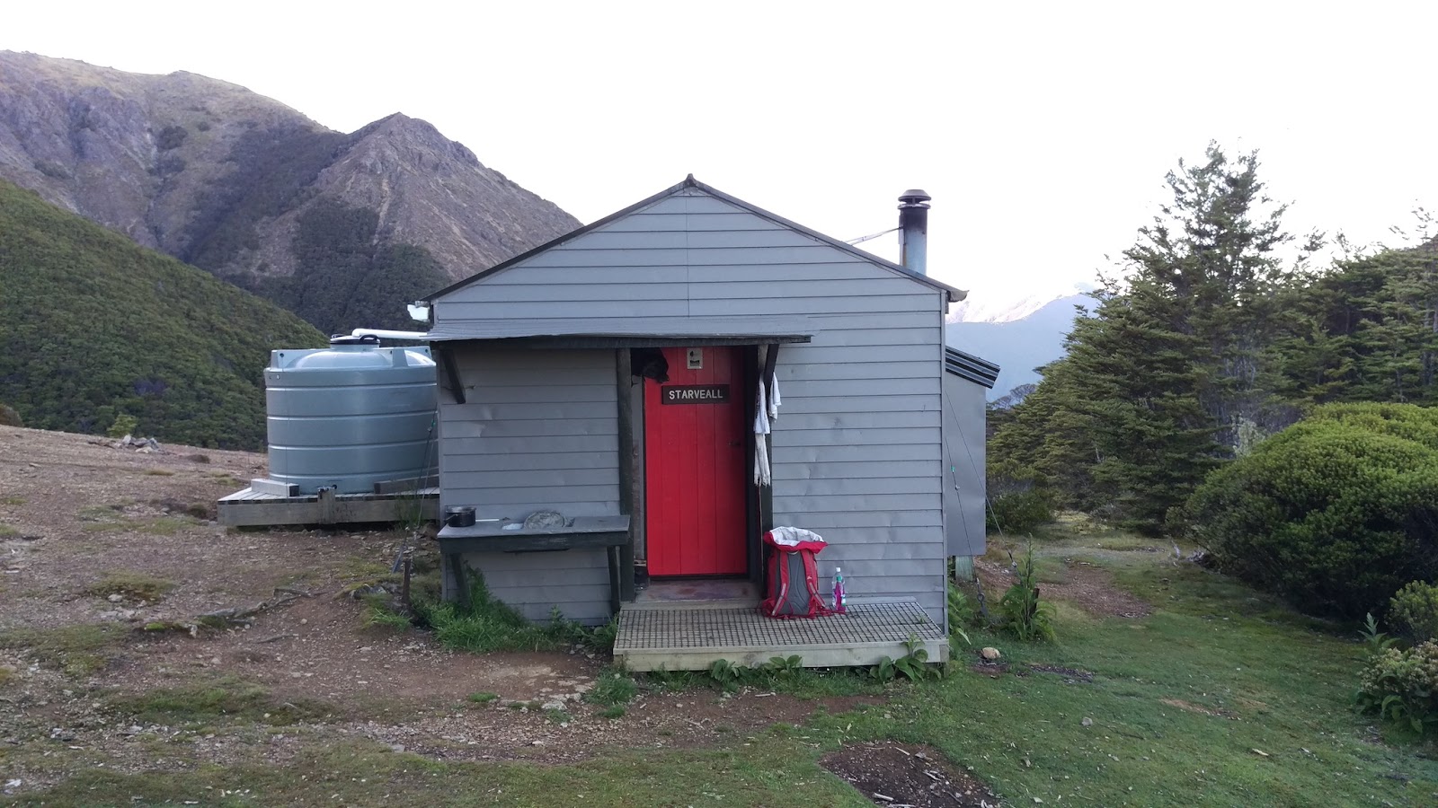
 |
| Starveall Hut |
 |
| Sparse forest |
Passed a party of three on the way, the only people I saw on the track for the four days, rest of the time it was seeing people at huts. Great views along the way, started to get hot.
 |
| Views from Starveall and along the tops perfect. |
 |
| Forested ridge to Slaty |
 |
| Looking at my destination |
 |
| Clouds in the distance |
 |
| Almost at Slaty |
 |
| Slaty Hut |
Stopped here for a cup of tea and a water bottle filling, another great hut.
 |
| Cloud coming as heading to Old Man |
 |
| Rolling in with views gone. |
 |
| Clag from now on, just minor views |
 |
| Tree area with gentle path |
 |
| Top of what? |
 |
| Edge trail |
 |
| Edge trail |
 |
| Another wee bump |
 |
| Rock stack |
 |
| Old Man Hut |
From Slaty hut to Old Man hut was a very pleasant walk arriving at mid
day, so that became my lunch hut. Had a Absolute Wilderness "Kumara
Potato Mash", a very nice addition to my meal.
 |
| The goat paddock |
 |
| Flower |
 |
| Top of ? |
 |
| Flower |
 |
| Skirting the the good bits |
 |
| Flower |
 |
| A big view |
 |
| Flower |
 |
| Sheep plant |
 |
| Weathered rock |
 |
| Nice flat top of Rintoul and f#[k the orange pole |
 |
| Mt Rintoul Hut |
Stopped here for another meal and rang home, as great cell coverage here. So far I had walked for ten hours and fifteen minutes, decided to head to Tarn and if empty sleep there for the night.
 |
| Forest on way to Purple Top |
 |
| Interesting plant |
 |
| Purple Top |
 |
| Some of that low silica rock |
Tarn Hut was full, just stopped to log intentions and onto Mid Wairoa Hut, which was plan B.
 |
| The Tarn with no name on BR26 |
 |
| Tarn Hut |
Had an interesting time listening to a bat flying around a tree, it got real noisy when I was shining my torch up in the tree, then it wasn't long before I was crossing the swing to Mid Wairoa hut and an enjoyable sleep.
Tuesday 03/01/2017
Not long after leaving the hut got my first wasp sting, this gorge is very interesting. There is a bit of up and down and the track is narrow and high above the river and at times crossing the river. With heavy rain this gorge section would be very difficult.
 |
| Mid Wairoa Hut |
 |
| Looking back into the first good gorge |
 |
| Edge trail |
 |
| Finally an interesting fungi |
 |
| Gentle flat river area |
 |
| Soft under foot |
 |
| Little waterfalls |
 |
| Into the mineral belt |
 |
| Top Wairoa Hut |
Rather wet by the time I got to Top Wairoa hut so lite the fire drying out my gear and waiting for the clouds to lift before heading to Hunters Hut.
 |
| Cloths dryer in the hills |
As I was leaving and preparing to douse the fire another walker arrived, so left the hut with the fire going.
 |
| Heading away from the smokey hut |
 |
| Wandering up to the saddle |
 |
| Interesting feature |
 |
| Ridgeline |
 |
| Looks like glaciation? |
 |
| Looking back down valley at Top Wairoa Hut |
 |
| The orange poles I so do not love |
 |
| Hunters Hut in the distance |
 |
| The orange poles.... |
 |
| Down valley to Hunters Hut |
 |
| Ultramafics |
Arrived at Hunters Hut and decided to stay as its a nice spot, and I would leave early the next day to ensure I made road end by 1400 hours.
 |
| Hunters Hut |
 |
| View back down the valley |
Shared my hip Flask of the Bowmore 10yo with a fellow tramper at Hunters Hut which was a very enjoyable dram as we discussed our explores of New Zealand.
Wednesday 04/01/2017
Up early to get out and meet Anthony at two p.m. at car park on SW6, expected it to be a long journey as read the Te Araroa notes.
 |
| view |
 |
| Porters Creek Hut (was xxxx) |
 |
| view |
 |
| Flower |
 |
| view |
 |
| View |
 |
| View |
 |
| From Red Hill Hut looking back |
 |
| Road down from Red Hills Hut |
 |
| View out to Wairoa Valley |
Meet Anthony on the way down from Red Hills and as we drove talked about the changes we had seen where the Te Araroa trail impacted on traditional back country areas. In general the back country is changing, its becoming a lot more commercialised, sign posted, with tracks marked so well that a map and compass are not needed.
The Te Araroa Trail
I do not like what the Te Araroa Trail has done to some of New Zealand's back country tracks, especially with the poles on the Mt Richmond alpine route; its more like "paint by numbers" tramping. The following points are what this walk way has caused to occur from my perspective:
- heavier trail traffic and the fragile areas are getting damaged
- hut capacity breached
- long drops that are near full
- poles plastered across traditional routes
- less solitude
Why are the routes getting dumbed down? Does that mean that people who are walking the Te Araroa walkway do not carry compass's or if they do, they don't know how to use them? Would be interesting to survey walkers and ask some questions like the following; not just Te Araroa walkers. Earlier in the year when I was in Taranaki a couple arrived at the hut we where at and complained of the lack of signs. Seemed they where heading for the next hut however they arrived back where they started, as they did a 360 around tree fall. When questioned they admitted that they did not have a compass or GPS.
- Do you have a compass?
- If you have a compass is it designed to work in the southern hemisphere?
- Do you have an NZTopo50 map or equivalent?
- Do you have a GPS?
- Do you know how to establish your location?
The Te Araroa strategy has this statement on the trail "Te Araroa takes walkers on a safe and
easily navigated journey show casing New Zealand". The whole strategy is a bit of nanny state fluff that reads like it was written by someone who works in a government department.
The Te Araroa trail is
sustainable, wonder what that means for the traditional Forest Service huts and there future?
While researching the proposed future management of our back country I had a read of DOC's Destination Management Framework. In the opening sentence there is a very worrying phrase "
how the place is marketed". The framework is all about increasing number into the back country and other DOC managed "assets".
The Te Araroa trail should have been a whole new track, not something that used existing infrastructure.
Map of Trip
Trip Times
Sunday 01/01/2017
1706 Left Hacket car park
1811 Hacket Hut
1817 Side trip to Browning Hut (jogging no pack)
1858 Browning hut
1929 Hacket Hut
1941 Left Hacket Hut
2226 Starveall Hut
Monday 02/01/2017
0655 Left Starveall Hut
0835 Slaty Hut
0924 Left Slaty Hut
1202 Old Man Hut
1310 Left Old Man Hut
1622 Rintoul Hut
1741 Left Rintoul hut
2014 Tarn hut
2016 Left Tarn Hut
2240 Mid Wairoa Hut
Tuesday 03/01/2017
0809 Left Mid Wairoa Hut
1112 Top Wairoa Hut
1412 Left Top Wairoa Hut
1817 Hunters Hut
Wednesday 04/01/2017
0608 Left Hunters Hut
0813 Porters Creek Hut
0847 Left Porters Creek Hut
1155 Red Hills Hut
1210 Left Red Hills Hut
1327 Car park on SH63
Some forgetful person from an Auckland tramping club accidentally left a book at Hunters Hut, which ended up at Porters Creek Hut; not to worry I will mail it back to them.
References
Alpine Route Mt Richmond Forest Park
Why wont my compass work on the other side of the equator?
Compass Types
You can find the Te Araroa strategy here
DOC's Destination Management Framework
Slowly fixing up this blog entry as I don't yet have all the flower names and have a few photos to add and others to correct.


No comments:
Post a Comment